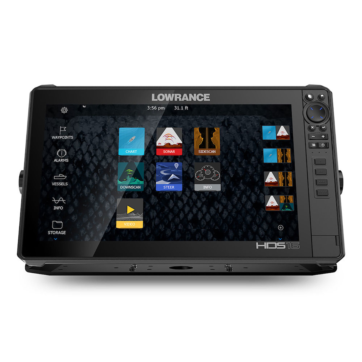
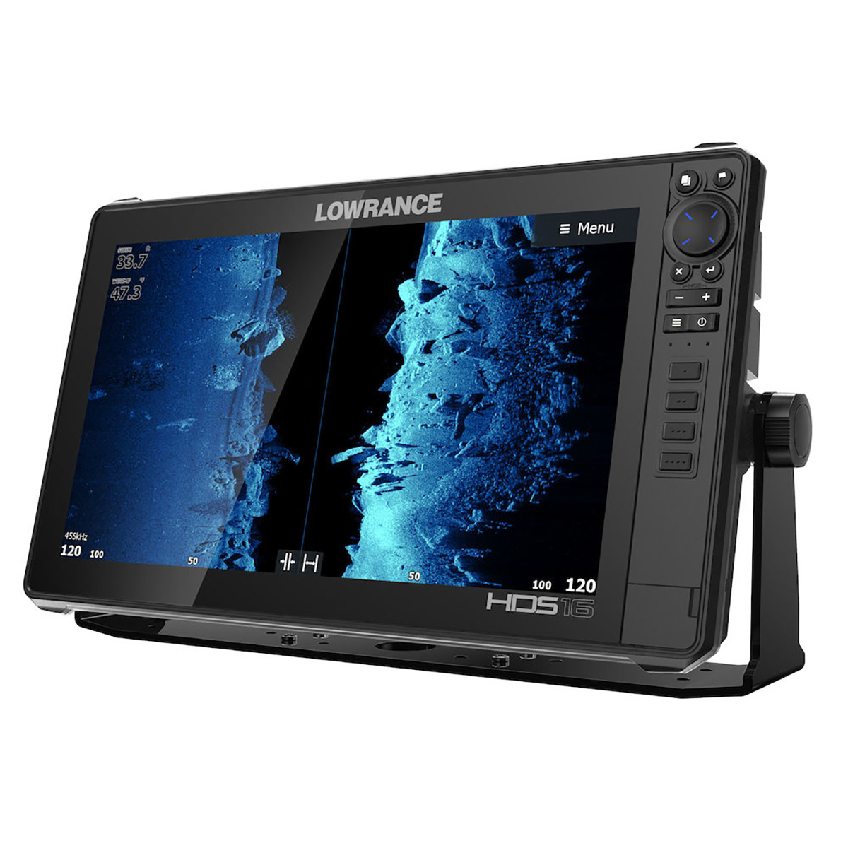
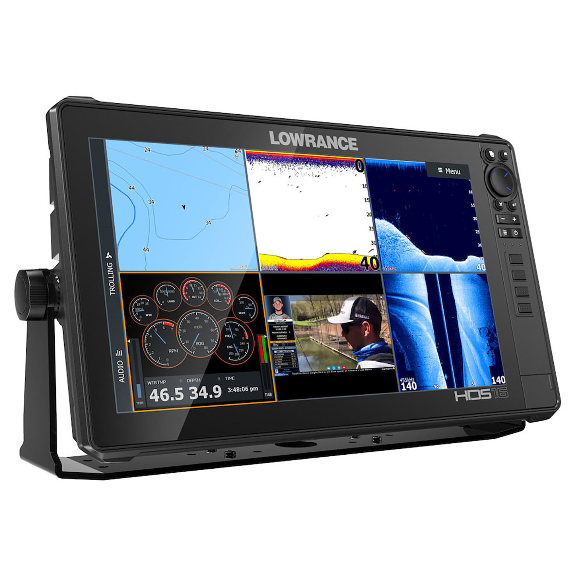
Year after year, more fishing tour pros use HDS than all other fishfinder brands combined. HDS LIVE 16 will undoubtedly carry on that tradition behind premium performance and support for the best collection of innovative sonar features available – from new Active Imaging™ and StructureScan® 3D with Active Imaging to FishReveal™ and LiveSight™ real-time sonar – you will experience a new level of fishfinding performance with HDS LIVE 16.
Navigating to your favorite fishing spot or finding a new one has never been easier, behind the best suite of navigation features ever built into an HDS display — including preloaded high-detail US, Australia, New Zealand or worldwide basemap, C-MAP® Easy Routing, Navionics® Autorouting* capability and C-MAP Genesis Live mapping.
HDS LIVE 16 simplifies your time on the water with onscreen text messages and call notifications, as well as support for LiveCast™ smartphone integration, which allows you to display video, Google Maps and fishing data on your fishfinder display.
Featuring a full high-definition SolarMAX™ HD screen, HDS LIVE 16 provides industry-leading images that are always easy to see – from any angle, in direct sunlight or even through polarized sunglasses.
HDS LIVE delivers powerful fishfinding sonar with a high-performance quad-core processor that produces the smoothest, lag-free operation, the most responsive touchscreen performance, and the fastest chart redraws and sonar updates.
*Navionics subscription required. See Navionics.com for more details
Active Imaging™ 3-in-1 (CHIRP/Side/Down) sonar ready*
Active Imaging™ 2-in-1 (Side/Down) sonar ready*
StructureScan® 3D compatible*
LiveSight™ real-time sonar compatible*
Smartphone notifications
LiveCast™ smartphone integration
High-performance quad-core processor
C-MAP® Genesis Live onscreen mapping
FishReveal™ Smart Target View
Full high-definition 16-inch SolarMAX™ HD multi-touch screen with the widest range of viewing angles – viewable even through polarized sunglasses
Preloaded high-detail US, Australia, New Zealand or worldwide basemap
C-MAP Easy Routing, Navionics® Autorouting capability
Dual-Channel CHIRP – dual sonar-range coverage from the same transducer
Live Network Sonar – cover more water and mark fish targets more clearly from a network of CHIRP sonar transducers
SiriusXM® Marine Weather and Audio compatible
Wireless and Bluetooth® connectivity
Heat Map feature allows anglers to see trends in water temperature changes to quickly target key fishing areas
Enhanced Surface Clarity lets you see more fish targets near the surface
Quick Access Control Bar provides one–touch access to system controls
Touchscreen control of MotorGuide® Xi5 Trolling Motor, Power-Pole® anchors and Lowrance Outboard Pilot
Radar and SonicHub®2 audio server connectivity
NMEA 2000® engine support
Optional mapping upgrades include C-MAP, Navionics® and more
Approvals
Compliance FCC, Industry Canada, Radio Equipment Directive, ACMA, RSM
Autopilot
Manouevres / Turn Patterns CourseHeadingWaypointPower SteerU-TurnC-TurnSpiralZigzagSquareLazy-S
Steering Modes CourseHeadingWaypointPower Steer
Connectivity
NMEA 0183 Sentences supported TX / RX – GPSReceive GGA GLL GSA GSV VTG ZDATransmit GGA GLL GSA GSV VTG ZDA GLCTX / RX – NavigationReceive RMCTransmit AAM APB BOD BWC BWR RMC RMB XTE XDRTX / RX – SonarReceive DBT DPT MTW VLW VHMTransmit DBT DPT MTW VLW VHMTX / RX – CompassReceive HDG HDT HDMTransmit HDGTX / RX – WindReceive MWV MWDTransmit MWV MWDTX / RX – AIS / DSC*Receive DSC DSE VDM*AIS sentences are not bridged to or from NMEA 2000.
Bluetooth Integrated Bluetooth 4.0 with support for Bluetooth Classic
Ethernet 2 x 100 Mbit, 6 max MFD’s on a network
NMEA 0183 1x RS422 port Baud rates: 1200, 2400, 4800 (Default), 9600, 19200, 38400, 57600, 115200
NMEA 2000 1x Micro-C
PC Connectivity None
Video Output:NoInput:HDMIComposite video RCA – singlechannel via optional adaptor
WiFi Internal 802.11b/g/n and Compatible with WiFi-1 Module
Display
Backlight Color Pure White LED
Resolution 1920 x 1080 Full HD
Screen Brightness >1200 Nits
Size and Type 16″ (406.4mm)SolarMAX HD (TM) IPStechnologyMulti-touch, P-CAP
Viewing Angles 80° top/bottom, 80° left/right
Electrical
Power Consumption, max. 4.9A @ 13VDC with Full Backlight, Sonar on
Power Consumption, min. 3.00 @ 13VDC with Full Backlight, Sonar on
Power Consumption, typical 3.00 @ 13VDC with Full Backlight, Sonar on
Recommended Fuse Rating 6.5A
Supply Voltage 12 v DC (10.8-17VDC)
Humidity 60°C, 95% relative humidity (RH) for 18 hours
Environment
Operating Temperature Range 5°F to 131°F (-15°C to 55°C )
Shock and Vibration 100,000 cycles of 20 G
Storage Temperature Range 4°F to 140°F (-20°C to 60°C )
Waterproof rating IPX7 with card door closed
GPS
Correction DGPS, WAAS
GPS Receiver Channels 16
Position Accuracy 20m RMS
Time to First Fix 30s
Update rate 10 Hz
MFD
AIS AIS Chart and Radar overlay. Target vessel details.
Autopilot Outboard PilotMotorGuide Xi5/Xi3 Trolling Motor **requires Motorguide PinPoint Gateway
Cartography included C-MAP World Background (ROW models)Navionics basemap (AMER and ROW models)
Cartography supported C-MAP (MAX N, MAX N+)C-MAP GenesisC-MAP Precision Contour HD (AMER ONLY)Navionics (Gold, NAV+ Platinum+)Insight (Pro and HD)Lowrance Regional Mapping Partners
Digital Switching CzoneNaviop
External Storage 2 micro SD cards up to 32GB
GPS 10 Hz GPS/GLONASS WAAS/EGNOS/MSAS
Internal Storage 8.0 GB Internal
Multimedia SonicHubSonicHub2FusionLink productsany NMEA 2000 compliant Marine Aduio products
Radar (inc. compatibility) 4G (Broadband)3G (Broadband)Halo24 (Pulse Compression Dome Radar)Halo 3’/4’/6′ (Open Array Pulse Compression Radar)
Sonar (inc. compatibility) Integrated: CHIRPBroadbandActive Imaging DownScanActive Imaging SideScanCompatible with: SonarHubStructureScanStructureScan3D
Weather SiriusXM via WM-3 (USA only)
Waypoints, Routes, Tracks 3000 Waypoints100 Routes100 Trails with up to 10,000 points per trail
Compass Safe Distance – Metric, imperial 12″ (300mm)
Physical
Dimensions (W x H x D) 16.95in (430.5mm) x 10.20in (259.2mm) x 3.46in (87.8mm)
Mounting Type Gimbal BracketFront Dash Flush MountRear Dash Flush Mount
Weight 7.94lb (3.60kg)
Other
Warranty Period 2 Year + 3 additional years ofupgrade optionsTotaling 5 years
Interface Touchscreen:Full Multi-touch touchscreenKeypad:8-way directional keypadZoom +/-ExitEnterMenuWaypointPower/Light4 – User Programmable Quick Access Keys


Avaliações
Não há avaliações ainda.